“Remote Sensing Helps Discover Hidden Treasures”
Imagine you’re on a desert island, searching for buried treasure. You’ve lost your map and don’t have any clues. You have two choices: you could walk around with a shovel, digging random holes and hoping to get lucky, or you could fly a drone above the sand. This drone could have special cameras that can see through the sand or detect the magnetic pull of coins and metals.
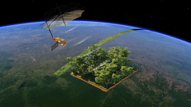
This may sound like a pirate story, but it’s actually real science called remote sensing. Remote sensing is a technology that lets scientists and engineers study the Earth from a distance without touching the ground.
Using satellites and drones, they can do many things: check how healthy a forest is, locate water deep underground, or even study the soil in faraway deserts. Remote sensing is helping people understand our planet better and find natural resources in a safe and efficient way.
With these tools, humans don’t need to dig blindly—they can see what’s hidden beneath the surface, making exploration faster, safer, and more accurate.